
Introduction
In India’s mining sector, survey teams still rely on spot leveling, manual traverses and legacy topographic maps. Regulatory scrutiny is increasing; margins are shrinking and the cost of being even a little off in resource estimation is huge. Geologists, mining engineers, surveyors, mine planners and safety officers have to make critical decisions based on incomplete, patchy data and that’s a recipe for surprises. SES Digital fills that gap as a drone surveying company in India by deploying drones, photogrammetry and 3D laser scanning services to turn opaque terrain into quantifiable insights, reduce risk and time.
Our pilots, survey engineers, GIS analysts and CAD/BIM modelers work together to convert raw data into drill-ready models, well-founded volume analytics, slope safety profiles and change detection reports you can act on immediately. In essence, our drones in the mining industry give you the full visibility of your resource base, with repeatable measurements that build trust, compliance and profitability.
How Drone Mapping & Surveying Deliver High-Resolution Topography & Volume Data
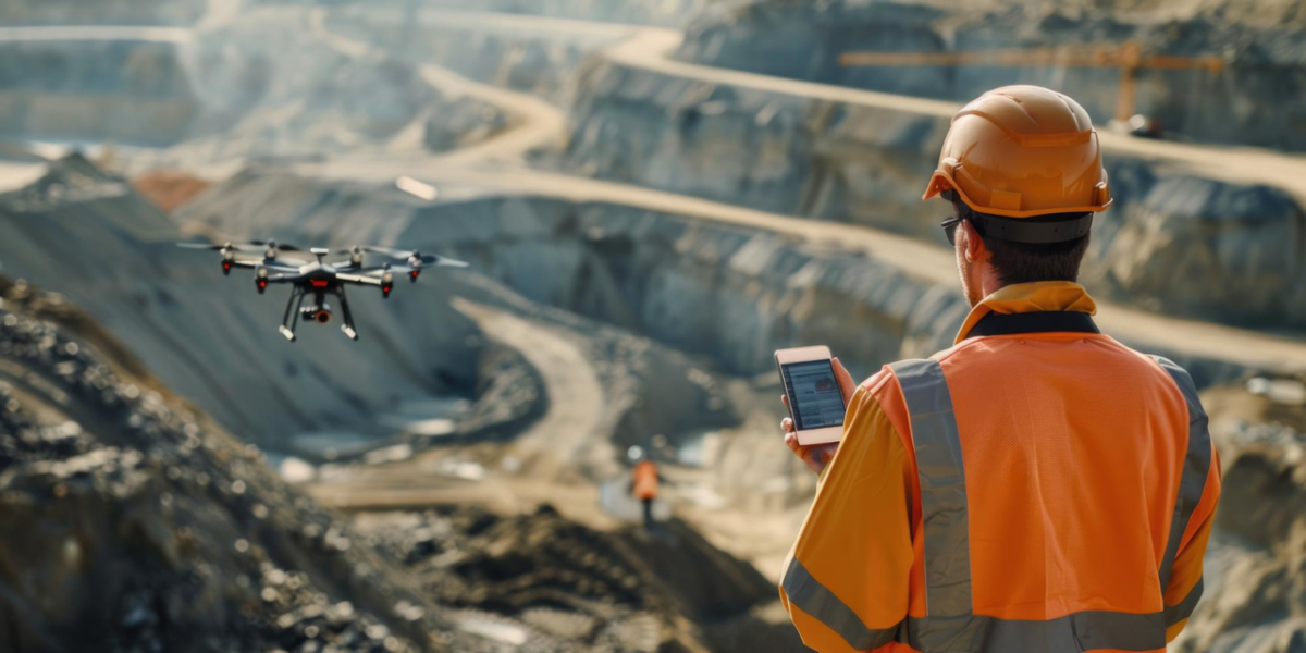
We send out a fleet of high-end UAVs equipped with top-grade RGB/multispectral cameras or LiDAR scanners to take a sweep over your mine. We program the flight paths and get the Real-Time Kinematic (RTK) all set to enhance drone positioning accuracy. Among the leading drone surveying companies in India capable of full-spectrum mining analytics, we make good use of tech to deliver orthomosaic maps, contour maps, point clouds and digital elevation, terrain and surface models.
For an open-cast mine, all these drone mapping services help you get a super accurate count of the overburden volume, work out the pit slope profile and keep an eye on erosion, all with centimeter-level precision. Because the data is airborne, you can get into those hard-to-reach places like steep quarry faces or benches without having to put people at risk.
Integrating Drones with 3D Laser Scanning for Detailed Geological & Pit Modeling
Our drone mapping services in India, along with 3D laser scanning, give you rich data from every angle. For mining, geology and pit modeling, this is a powerful combination. It allows your engineers and geologists to build highly accurate 3D digital twins of pits. These models capture bench heights, catchment volumes, slope stability zones, displaced material and areas where geotechnical hazards like rock falls or subsidence could occur.
Beyond raw geometry, drones in the mining industry help validate geological mapping, assess pit slope stability against design criteria and feed data into simulations for water flow, sedimentation and flood risk. You also get mesh-based textured models that allow visual walkthroughs and inspection planning without putting people in harm’s way.
The Many Applications of Drones in the Mining Industry
Stockpile Monitoring – With orthomosaics, elevation models and point clouds, SES Digital helps you compute stockpile volumes. You can monitor shrinkage, loss or theft and check compliance with regulatory standards.
Pit Deformation and Wall Stability – Using frequent drone mapping flights and laser scans of faces, you can detect small movements, cracks or bulging and compare successive datasets to identify deformation. This helps in planning reinforcements, adjusting slope angles and avoiding catastrophic collapses.
Safety & Risk Management – Drones can examine areas that are dangerous, steep, collapsed or hard to reach. This approach by our drone surveying company means safety officers, engineers and mine managers get complete situational awareness.
Resource Optimization – High-resolution drone data makes blast designs sharper, haul paths smarter and load estimates more accurate while cutting waste at every step. They also make reconciling real output with reserve estimates faster and more reliable.
Conclusion
In India’s complex and expansive mining sector, SES Digital stands out by turning raw terrain into quantified opportunity. Mining engineers, planners and safety managers who work with us get insights that change strategy, be it reducing waste, improving safety or closing the gap between forecasted and actual reserves. Our expertise and experience as a drone surveying company flows through every layer of impact – environmental compliance, transparency to regulators, stakeholder trust and better margins. Take your mining operations to the next level with SES Digital.