
Ask any project manager who’s run a large construction site in India, and they’ll usually have a version of the same story. The site is spread across multiple hectares. There are parallel work packages happening at different elevations, different zones, sometimes different contractors. Keeping an accurate picture of what’s actually happening on the ground at any given point is, to put it politely, a logistical headache.
The old way of dealing with that was more people. More site supervisors. More manual reporting. More coordination calls where half the meeting is spent reconciling conflicting updates from different parts of the site.
That approach doesn’t scale. And as construction projects in India grow larger and more complex, whether it’s infrastructure, oil and gas, mining, or industrial facilities, the gap between what ground-level monitoring can capture and what project teams actually need to know keeps getting wider.
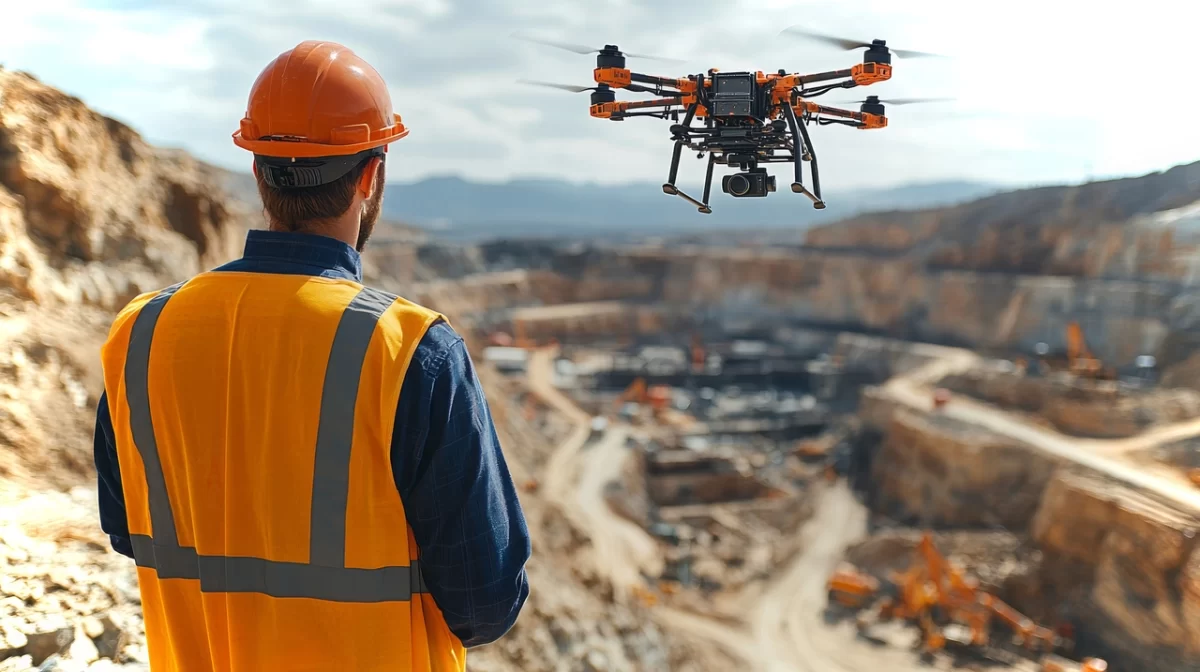
Drone surveying has moved into that gap. Not as a novelty, not as something reserved for large international EPC firms, but as a practical tool that’s reshaping how sites are understood, documented, and managed.
The Growing Complexity of Large Construction Sites
Large construction projects have always been complicated. But the nature of that complexity has shifted.
Sites today often involve multiple concurrent work fronts, tight interdependencies between civil, structural, mechanical, and electrical packages, and delivery schedules that leave little room for the kind of lag that traditional monitoring introduces. A delay in one work zone that goes undetected for a week can quietly knock out the schedule for two others downstream.
There’s also the scale of the physical area involved. A new oil and gas facility, a large industrial plant, a greenfield infrastructure project, these aren’t things you can meaningfully observe from any single vantage point. Getting a true picture of the whole site, at any given moment, requires either a lot of people moving around constantly or a technology that doesn’t have that limitation.
Add to that the increased accountability demands from clients and stakeholders who want regular, verifiable progress data rather than subjective field reports, and the case for a better monitoring approach becomes fairly clear.
Where Traditional Surveying and Ground-Level Monitoring Fall Short
The honest problem with traditional ground-level surveying on large construction sites isn’t competence. It’s physics. A person on the ground can only observe what’s in their line of sight, document what they can physically access, and report what they’ve seen by the time they make it back to the site office.
On a site sprawling across dozens of acres with active construction happening at multiple levels simultaneously, that creates real gaps. Some areas are simply difficult to access safely during active work phases. Others are too remote from the main site office to monitor frequently. And progress reports compiled from field walks taken at different times of the day, by different people, tend to produce data that’s inconsistent at best.
There’s also the safety dimension. Sending surveyors into active construction zones, or onto structures that are still being built, carries risk. The same is true of inspection work on elevated structures, storage tanks, or areas with hazardous conditions. Ground-level access isn’t always the right answer, even when it’s technically possible.
The reporting cycle is another friction point. Manual site walks, data compilation, report preparation, review, and distribution can take days. By the time a project manager in a head office sees an updated progress report, the site has moved on. The data is already old.
What a Drone Surveying Company in India Actually Delivers on a Construction Site
Adrone surveying company in India like SES Digital doesn’t just send a drone up to take aerial photographs. The deliverables are considerably more useful than that.
SES Digital’s drone services cover aerial surveying and mapping using high-end drones equipped with RGB cameras, multispectral sensors, and LiDAR payloads. The raw data captured during a flight is processed through photogrammetry software to produce outputs that engineering and project management teams can directly work with: Orthomosaic maps, Digital Elevation Models (DEM), Digital Terrain Models (DTM), Digital Surface Models, 3D point clouds, 3D textured mesh models, and contour maps.
On a greenfield oil and gas project, for instance, SES Digital used this exact combination of drone-based LiDAR scanning and GIS processing to give a client precise land dimensions, topographical detail, and a data-backed basis for deciding where to place pipe racks, vessels, and refinery equipment. That kind of decision, made on accurate spatial data rather than approximation, has a direct effect on how well the facility comes together during construction and how efficiently it operates afterward.
For brownfield projects and ongoing construction monitoring, the same approach applies differently. Drones fly defined routes on a set schedule, capturing consistent imagery and survey data that can be compared over time. Progress is visible. Deviations from plan are detectable early. The project team isn’t waiting for someone to walk the site and write a report.
Real-Time Progress Monitoring and What It Actually Changes
There’s a version of progress monitoring that involves a site manager walking around with a clipboard, making notes, and producing a weekly update that’s already three days old by the time it’s read. That version is still surprisingly common.
Drone-based monitoring works differently. Regular aerial surveys produce documented, geo-referenced data that shows exactly what has been completed, where work is happening, and how the current state of the site compares to the construction schedule. Not impressionistically. Precisely.
SES Digital integrates drone services with broader real-time progress monitoring capabilities. Cloud-based tools that can receive, process, and present aerial data alongside other project metrics give project managers a view of site conditions that doesn’t depend on being physically present. A client in a head office in Mumbai can have an accurate picture of what’s happening on a site in Gujarat, with documentation to support it.
The practical shift this creates is important. When progress monitoring is faster and more reliable, deviations from schedule surface earlier. Earlier detection means earlier intervention, before a small slip becomes a significant delay. That’s not a minor operational improvement. On a large industrial construction project, catching a two-week scheduling risk four weeks early is the difference between a manageable adjustment and a crisis.
Drones in the construction industry are also being used for safety inspections of elevated or structurally sensitive areas, reducing the need to send personnel into potentially hazardous conditions. Thermal cameras mounted on drones can identify issues that are invisible to the naked eye. For sites with confined spaces, tanks, or chemical storage, that capability has real value beyond just survey work.
Benefits for Project Planning, Tracking, and Cost Control
The cost argument for drone surveying is straightforward once you work through it.
Field surveys done by ground-level teams on large sites take time and cost money. More importantly, they produce data with gaps. Decisions made on incomplete data, or on data that’s a week old, tend to produce expensive corrections later. The construction industry’s wider record on cost overruns is well documented, and a significant portion of those overruns trace back to planning and monitoring failures, not to the physical work itself.
Drone mapping services compress the time it takes to generate accurate site data, and they do it at a scale and consistency that ground teams simply can’t match. Fewer repeat site visits by expensive engineering teams. Less time spent reconciling conflicting progress reports. Earlier identification of work that’s drifted off plan.
For project planning specifically, having accurate topographic and spatial data before construction begins, captured by drone survey rather than traditional ground methods, means fewer surprises once the earthworks or foundations start. For a new facility development, knowing the exact land dimensions, terrain variations, and site conditions in advance shapes every downstream decision about layout, logistics, and sequencing.
SES Digital’s drone inspection services in India extend beyond new builds as well. Chemical plants, oil and gas facilities, and manufacturing sites that need regular inspection of structures, tanks, and equipment can use drone-based inspection to reduce the time, cost, and human risk involved in that work. Regular, documented inspection data also supports maintenance planning and regulatory compliance in a way that sporadic manual inspections don’t.
Drone Surveying Is Becoming a Standard, Not an Upgrade
The shift happening right now is less about drone surveying proving itself and more about it becoming expected.
Large EPC contractors and industrial facility developers are increasingly specifying drone-based survey and monitoring as part of their standard project methodology, not as an optional add-on. The reasons aren’t complicated. The data is better. The turnaround is faster. The coverage is more complete. And the cost, measured against the value of the decisions it enables, is very reasonable.
SES Digital has been delivering drone inspection services in India across construction, chemical, oil and gas, mining, agriculture, and energy sectors, working with over 200 clients across 88+ countries. Their capability covers the full workflow, from aerial data capture using drones equipped with LiDAR and RGB sensors, through GIS processing, to delivery of usable engineering outputs like orthomosaic maps, elevation models, and 3D models.
For project teams still relying on manual surveys and periodic site walks to track progress on large construction projects, the question isn’t really whether drone surveying would improve things. It’s how much the current approach is costing, in delays, in reporting lag, in decisions made on incomplete information.
That’s usually where the conversation ends and the engagement starts. If your project is large enough that you can’t easily see all of it from any single point, it’s large enough to benefit from drone mapping services.
Reach SES Digital at sesdigitalsolutions.com or call +91-7486933588.